UF Institute of Food and Agricultural Sciences Research
Give      University of Florida
Resources
    Toggle Search Form
    GIVE UNIVERSITY OF FLORIDA
    • HOME
    • About the Station
          • Overview
          • Facilities
          • Contact
          • Volunteers
          • Job Opportunities
    • For Visitors
          • FAQs
          • Directions
          • General Policies
          • What to Bring
          • On-Site Lodging
    • For Researchers
          • FAQs
          • Project Portal and Data Access
          • Research Policies
          • Fee Schedule
          • On-Site Lodging
          • Conservation Resources
          • External Data Portals
          • NEON
          • Publications
    • For Educators
          • FAQs
          • Project Portal
          • Teaching at OSBS
          • Conservation Resources
          • On-Site Lodging
    • For Media
          • Conservation Resources
          • Fire at OSBS
          • NEON
          • Brochure
          • Videos

    UF/IFAS Ordway-Swisher Biological Station

    UF/IFAS Ordway-Swisher Biological Station

    Conservation Resources

    Conservation at OSBS

    The Station's conservation mission is to protect, maintain, and monitor the ecological integrity of the Station's habitats and species. Proper stewardship of the Station's natural resources are also integral to many of the legal obligations that the Station is responsible for maintaining.

    The Nature Conservancy logo

    Safe Harbor Logo

    UF maintains a conservation easement with The Nature Conservancy on most of the land that comprise the field station. A conservation easement is a voluntary, legally binding agreement between a landowner and a qualified land trust or government entity that permanently limits uses of the land in order to protect ecological, historic, or other scenic resources. UF’s easement agreement is designed to protect the natural resources of the Station and at the same time integrate research, teaching, and extension activities.

    UF established a Safe Harbor Agreement (SHA) with the US Fish & Wildlife Service for Red-cockaded woodpeckers (RCWs) at OSBS in 2009. Red-cockaded woodpeckers are protected under the federal Endangered Species Act, meaning landowners have a legal obligation to protect the birds and their habitat. A Safe Harbor Agreement is a voluntary agreement involving private or other non-Federal property owners whose actions contribute to the recovery of species listed Safe Harbor Program Signage as threatened or endangered under the Endangered Species Act (ESA).

    • Plant Communities
    • Plant Communities


      FNAI Vegetation Communities

      FNAI Natural Communities

      Basin Marsh Basin Swamp Baygall
      Basin Marsh Basin Swamp Baygall


      Classic Upland Lake Lake Bottom Mesic Hammock
      Clastic Upland Lake Lake Bottom Mesic Hammock


      Sandhill Sandhill Upland Lake Scrubby Flatwoods
      Sandhill Sandhill Upland Lake Scrubby Flatwoods


      Xeric Hammock
      Xeric Hammock


      FNAI Altered Landcover Types


      Abandoned Field and Pasture Borrow Area
      Abandoned Field/Pasture Borrow Area
      Pine Plantation Successional Hardwood
      Pine Plantation Successional Hardwood Forest
    • Blank
    • Blank
    • Species
    • Species

      There is quite a diverse array of species to study at OSBS. Efforts to identify and catalogue species have been ongoing since the Station’s inception. There are over 700 plant taxa along with their DNA barcodes that have been entered into the FLMNH Herbarium. 284 vertebrate species have also been cataloged for the Station. The Florida mouse, Sherman fox squirrel, gopher tortoise, striped newt, rosemary wolf spider, bald eagle, gopher frog, and black bear are some examples of species that frequent the site. Due to the wide array of diversity, identification and collection of invertebrate species, fungi, and lichens is ongoing.

      Plants Vertebrates Invertebrates Non-Vascular
      700+ Taxa
      • Amphibians (27)
      • Repitles (45)
      • Birds (149)
      • Fishes (26)
      • Mammals (37)
      • Ants (101)
      • Beetles (84)
      • Grasshoppers (31)
      • Lepidoptera (488)
      • Gastropods (8)
      • Fungi Guide
      • Lichens Guide
    • Blank
    • Blank
    • Geology
    • Geology

      The Station is located at the southern end of the Northern Highlands geomorphic feature, which is west of the Florahome Valley geomorphic feature and southeast of the base of the Trail Ridge geomorphic feature. Highland areas often coincide with areas of high recharge for aquifers. Many highland areas have variably developed karst features that allow for rapid infiltration of surface water (and pollutants) into the aquifer system (Readle 1990, Scott 1992). The oldest Cenozoic era sediments in the area of the Station are the Cedar Keys Formation, which have been dated at 55 to 65 million years before present. This formation is 1500 feet to 1700 feet below the National Geodetic Vertical Datum of 1929 (NGVD, formerly called mean sea level) and is approximately 500 feet thick (Figure ). The top of the next layer lies approximately 1000 to 1200 feet below NGVD and is known as the Oldsmar Formation. These two layers contain no potable water (Motz, et al. 1991 and 1992, Readle 1990, Scott 1992).

      The Florida Aquifer occupies the next four layers of sediment. These have been named the Avon Park Formation and the Ocala Group. All of these sediments from the Paleogene are dominated by dolomite and limestone. Layers from the Oligocene are absent in Northeast Florida (Motz, et al. 1991 and 1992, Readle 1990, Scott 1992, Yobbi, et al. 1979). The upper confining layer of the Floridan Aquifer is the Hawthorn Group. The top of the Hawthorn Group is estimated at 0 feet to 100 feet above NGVD and is believed to be between 50 and 200 feet thick. The dominant sediments are clastics of quartz sands and clays. There is very little potable water available in these sediments. Other layers of the Neogene are thin or absent in western Putnam County (Bonoil, et al. 1993, Motz, et al. 1991 and 1992, Readle 1990, Scott 1992, Yobbi, et al. 1979). Above this is a layer of unnamed sands that is sometimes described as the Anastasia Formation. These sands form the soils of Putnam County. There is a shallow aquifer within these sediments (Beadle 1990, Scott 1992).

      • Bonoil, D., M. Williams, and D. Munch. 1993. Mapping recharge to the Floridan aquifer unsing a geographic information system. St. Johns River Water Management District, Technical Publication SJ93-5, Palatka, Florida. pp 41.
      • Motz, L.H., J.P. Heaney, W.K. Denton, M.S. Fowler, and G. Leiter. 1992. Upper Etoniah Creek Hydrologic Study, Phase II Final Report. St. Johns River Water Management District, Technical Publication SJ92-SP18, Palatka, Florida. pp 414.
      • Scott, T.M. 1992. A geological overview of Florida. Open File Report No.50. Florida Geological Survey, Tallahassee, Florida. pp78.
      • Readle, E.L. 1990. Soil survey of Putnam county area, Florida. USDA, SCS. Pp 224.
      • Yobbi, D.K. and G.C. Chappell. 1979. Summary of the Hydrology of the Upper Etonia Creek Basin. Edited by Frank W. Fenzel. Technical Publication SJ79-5. Water Resources Department, St. Johns River Water Management District, Palatka, Florida. pp 89.
    • .
    • .
    • Soils
    • Soils

      Soils Map

      The major upland soils on OSBS are of the Candler Apopka Series. These are excessively drained to well-drained sandy soils with a depth up to 80+ feet. Some of the areas are sandy to a depth of 40 to 79 inches, with a loamy subsoil below. Water levels of lakes located in these soils will fluctuate depending on rainfall, seepage, and underground aquifers (Readle 1990). The major lowland areas of the Station are of the Okeechobee Samsula Series. These are very poorly drained organic soils. The organics can be 51 + inches deep, or 16 to 51 inches deep with a sandy layer below. The muck of Okeechobee soils can extend to 80+ inches. These soils are associated with the marshes and swamps (Readle 1990).

      • Readle, E.L. 1990. Soil survey of Putnam county area, Florida. USDA, SCS. Pp 224.
    • .
    • .
    • Topography
    • Topography

      Topography Map

      The topography at the Station is rolling sand hills. There are numerous shallow lakes and ponds interspersed among the hills. In the southwest corner of the Station there is a series of lakes, swamps, marshes, and prairies that flow to the northeast corner of OSBS. This drainage is relatively flat with an elevation difference of less than 10 feet. The highest point is 182 feet NGVD and is found in the western half of the Station. This is a sandhill northwest of Anderson Cue Pond near Mill Creek. The lowest point is in Putnam Prairie and is approximately 94 feet NGVD.

    • .
    • .
    • Hydrology
    • Hydrology

      The Station lies in the Upper Etonia Creek Basin, which is part of the Lower St. Johns River Basin. Water in the basin generally flows eastward to Etonia Creek. The creek continues eastward to Rice Creek. Rice Creek drains into the St. Johns River, which flows northward to Jacksonville where it empties into the Atlantic Ocean.

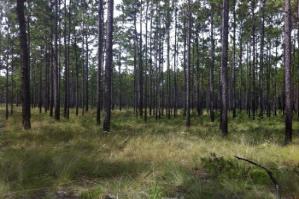
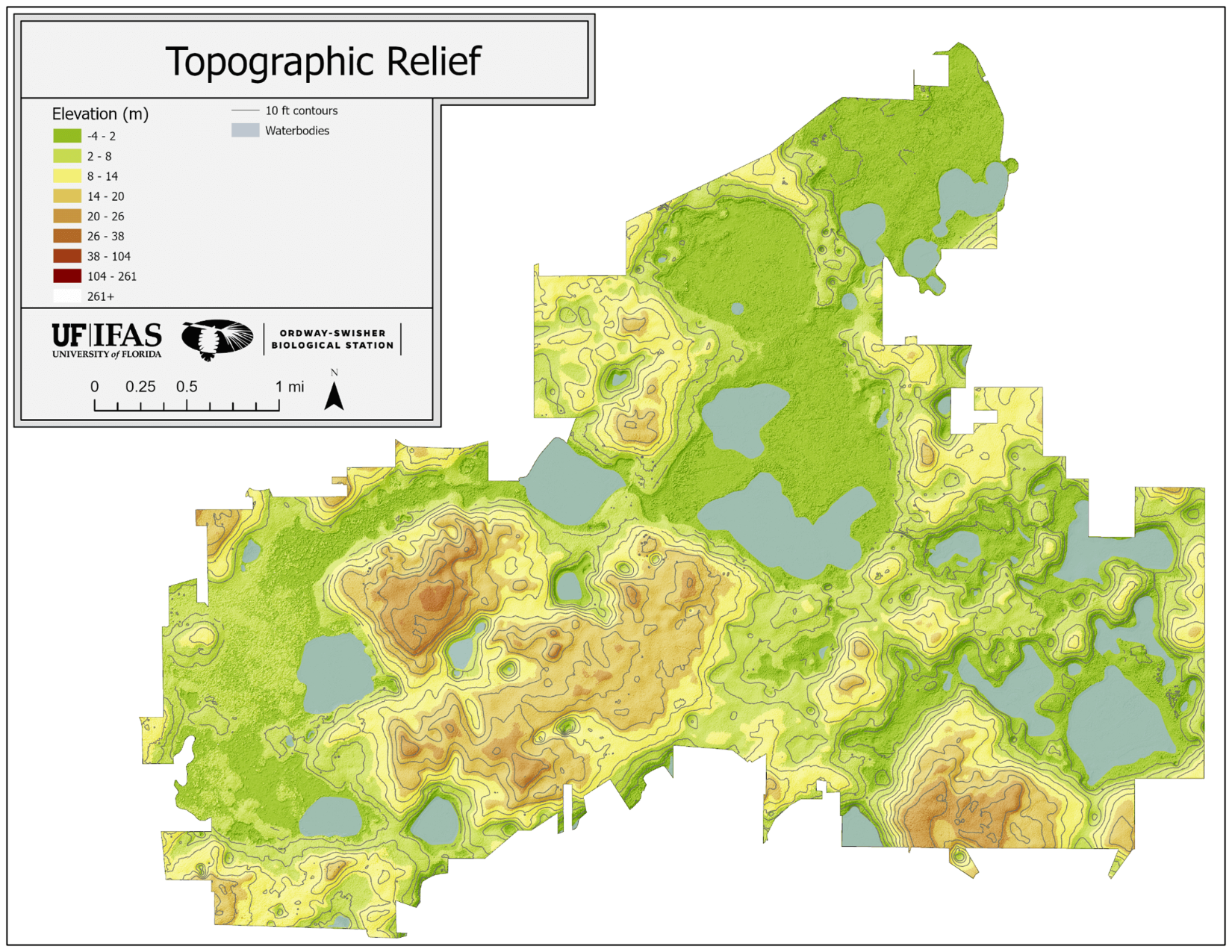
      The Upper Etonia Creek Basin has three aquifers: the surficial aquifer, the intermediate aquifer and the Floridan Aquifer. The surficial aquifer is more commonly known as the water table. The water table generally conforms to topography but with reduced relief and varies in elevation from approximately 70 to 175 feet above NGVD. The base of the water table is where the Hawthorn Formation lies as an aquiclude. The general flow of this aquifer, on the Station, is to the east and northeast. Recharge for this aquifer is from local precipitation. Most of the residential water in the area is drawn from this source (Motz, et al. 1991 and 1992, Yobbi, et al. 1979).

      The intermediate aquifer is composed of pockets of water situated within the Hawthorn Formation. These pockets may or may not be connected and there may be breaks in the soil layers that permit recharge of these pockets from either the surficial aquifer or the Floridan (Motz, et al. 1991 and 1992, Yobbi, et al. 1979).

      The top of the Floridan Aquifer is approximately 0 feet NGVD. The potentiometric surface of the Floridan has been measured at 80 in the vicinity of OSBS. By mapping the potentiometric surface of the Floridan, a mound, or potentiometric high, can be seen in the vicinity of the Station. This indicates an area of high recharge for the Floridan Aquifer. Recharge to the Floridan is estimated to be between 0 to 12 inches per year for different areas of OSBS. The Floridan Aquifer is used by industry and agriculture for water needs (Bonoil, et al. 1993, Motz, et al. 1991 and 1992, Yobbi, et al. 1979).

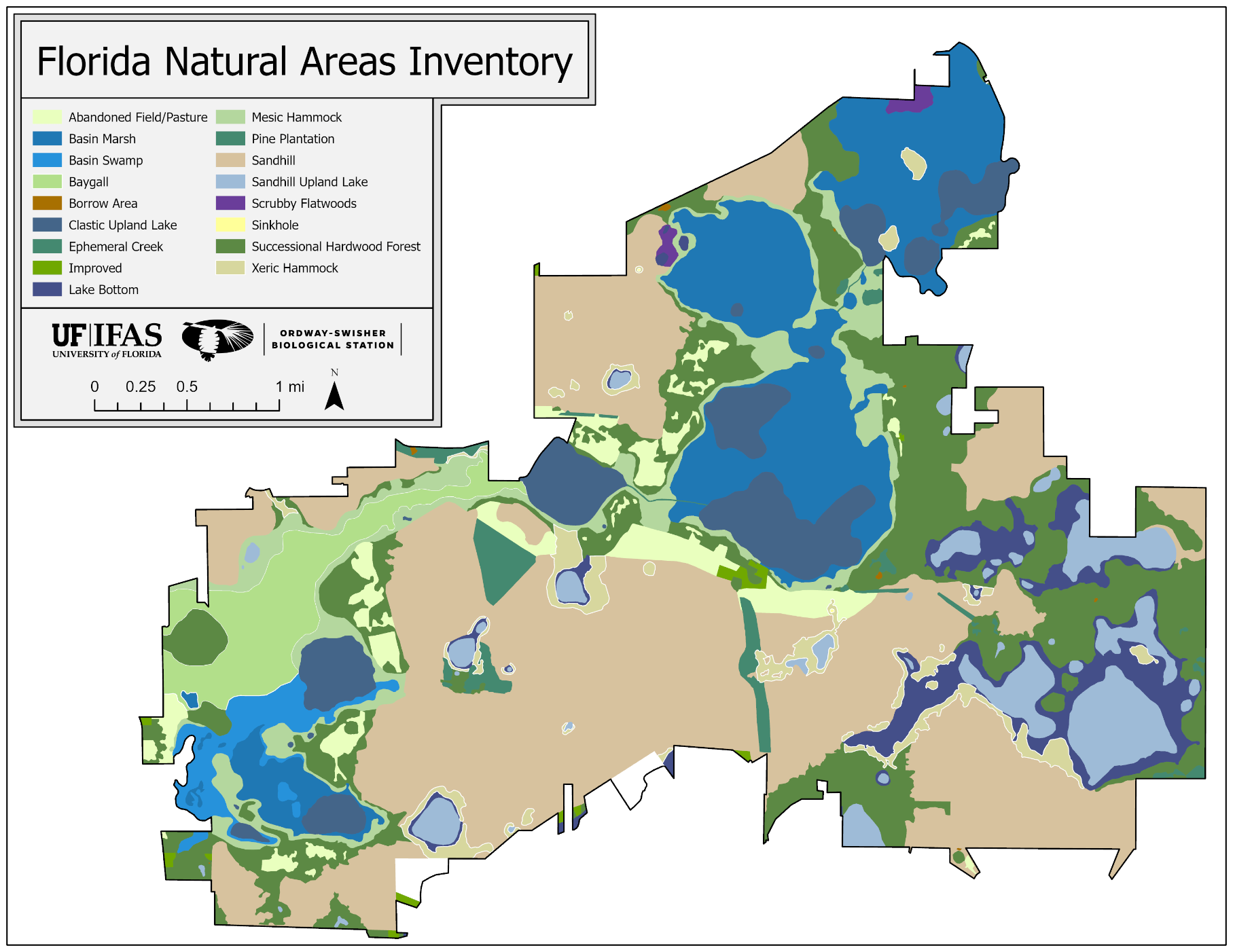
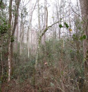
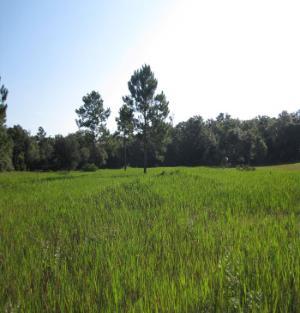
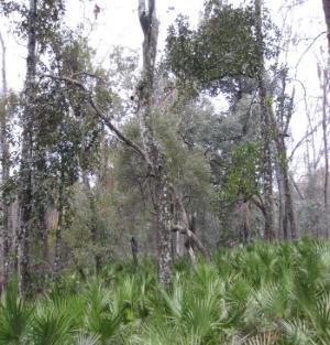
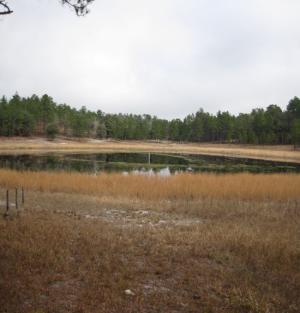
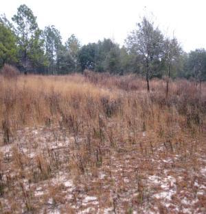
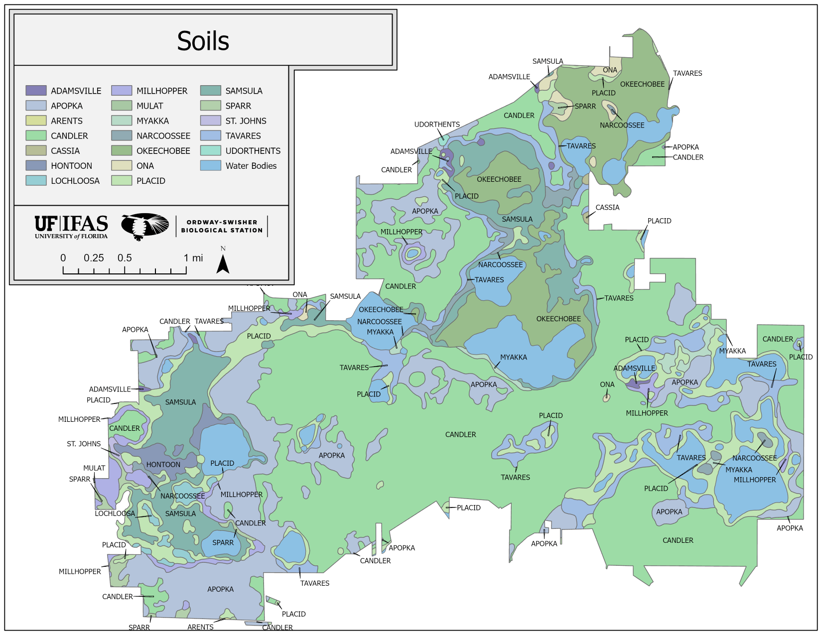
      Included in the surficial aquifer are the lakes and ponds of the Station as well as the wetlands. These are divided into two systems within OSBS that are described as the clear water system and the dark water system. The clear water system is composed of the sandhill lakes and ponds that are scattered throughout the property. These are very dynamic wetlands that are dependent on precipitation. As a result, there can be large seasonal fluctuations in water levels. During drought, many of these ponds can and will dry up (Motz, et al. 1991 and 1992, Yobbi, et al. 1979).

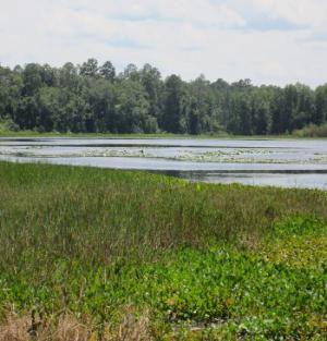
      The darkwater system flows from the southwestern corner of the Station to the northeastern corner of the property. Water in Lake Rowan flows northward into Lake Suggs and Mill Creek. Mill Creek drains eastward into Ross Lake, which feeds Goose Lake and Ashley Prairie. Water from Ashley Prairie supports Harry Prairie and Putnam Prairie. Putnam Prairie drains eastward through a culvert under Highway 100 into Goodson Prairie. Goodson Prairie supplies water to Etonia Creek.

      The darkwater system does not appear to be as dependent on precipitation as the clearwater system, but lake levels will still fluctuate with rainfall. During drought some areas of open water may completely evaporate. During periods of high rainfall a chain of lakes north of OSBS flows into Putnam Prairie.

      • Bonoil, D., M. Williams, and D. Munch. 1993. Mapping recharge to the Floridan aquifer unsing a geographic information system. St. Johns River Water Management District, Technical Publication SJ93-5, Palatka, Florida. pp 41.
      • Motz, L.H., J.P. Heaney, W.K. Denton, M.S. Fowler, and G. Leiter. 1992. Upper Etoniah Creek Hydrologic Study, Phase II Final Report. St. Johns River Water Management District, Technical Publication SJ92-SP18, Palatka, Florida. pp 414.
      • Yobbi, D.K. and G.C. Chappell. 1979. Summary of the Hydrology of the Upper Etonia Creek Basin. Edited by Frank W. Fenzel. Technical Publication SJ79-5. Water Resources Department, St. Johns River Water Management District, Palatka, Florida. pp 89.
    • .
    • .
    • Climate
    • Climate

      The climate of the Lakes Region of North Central Florida is humid subtropical. Summers are long, warm, and relatively humid. Winters are mild and relatively dry. Summer's average maximum daily temperature is 89'F with an average minimum daily temperature of 70`F. Winter's average maximum daily temperature is 67°F and the average minimum daily temperature is 40"F. The frequency of frost and freezing is greater in the western part of Putnam County than the eastern part, with temperatures of 32`F or lower occurring approximately 8 to 10 times per year. Prevailing winds are northerly in the winter and fall, and southerly in the spring and summer (Readle 1990).

      The average yearly precipitation for Gainesville is 51.04 inches. Consistent rainfall data is available from 2001 for the station. The station has network of four meteorological stations, which each collect rainfall data. Over half of the precipitation in the area tends to fall during the months of June to September. Typically this rainfall is due to local showers and thunderstorm development. There is a weak second peak of rainfall during the spring. This is due to frontal activity which penetrates peninsular Florida during this time of year (Chen and Gerber 1990, Division of Hydrologic Data Services 1994, Motz, et al. 1991 and 1992, Yobbi, et al. 1979).

      • Chen, E., and Gerber, JF 1990. Climate. In Ecosystems of Florida. pp. 11-34. R. Myers and J. Ewel, eds. University of Central Florida Press, Orlando, Fla.
      • Division of Hydrologic Data Services. 1994. Hydrologic conditions report, May 1994. St. Johns River Water Management District, department of Water Resources. pp 68.
      • Motz, L.H., J.P. Heaney, W.K. Denton, M.S. Fowler, and G. Leiter. 1992. Upper Etoniah Creek Hydrologic Study, Phase II Final Report. St. Johns River Water Management District, Technical Publication SJ92-SP18, Palatka, Florida. pp 414.
      • Yobbi, D.K. and G.C. Chappell. 1979. Summary of the Hydrology of the Upper Etonia Creek Basin. Edited by Frank W. Fenzel. Technical Publication SJ79-5. Water Resources Department, St. Johns River Water Management District, Palatka, Florida. pp 89.
    • .
    • .
    • Overview
    • Overview

      With over 9600 acres to manage of diverse plant communities, species, and water resources, natural resource management plays a significant role in meeting OSBS’s missions. The Station’s conservation program uses adaptive management practices to help direct work flows. Tools such as prescribed fire for pyrogenic habitats, mechanical/chemical treatments for controlling exotic/invasive species, and silvicultural practices along with groundcover harvesting for restore disturbed habitats are all used in stewardship of this unique facility.

    • .
    • .
    • Fire Management
    • Fire Management

      As in many of Florida's pyrogenic communities, prescribed fire is our primary conservation tool used to maintain the natural fire regimes. Prescribed fire, also known as controlled burning, is the skillful application of fire to wildland fuels in either their natural or modified state, under specified environmental conditions which allow the fire to be confined to a predetermined area and at the same time to produce the intensity of heat and rate of spread required to attain planned resource management objectives. A combination of dormant and growing season prescribed burns as well as lightening ignited fires are utilized to maintain the longleaf pine-wiregrass community on the Station.

      The Fire Management Program at OSBS integrates habitat management with research/education/training as often as possible. An example of this is the annually mentoring opportunity for students to participate on prescribed fires with wildland fire professionals from the National Interagency Prescribed Fire Training Center at Ordway-Swisher in the winter and spring months.

    • .
    • .
    • Exotic Species
    • Exotic Species

      Due to the long history of the Station’s lands being under few owners as well as good resource management practices, exotic plant species have not been a major problem. As in most conservation lands, efforts to scout, map, and control unwanted species are ongoing. Most occurrences happening along boundaries with neighbors and roadways as well as new property acquired that may have had a different land use. There are some exotic species such as bahaigrass for example that occurs in old fields and along some roads that we have chosen to live with.

    • .
    • .
    • Groundcover Seed Harvesting
    • Groundcover Seed Harvesting

      Restoration of native groundcover is imperative in restoring native plant communities and systems processes such as fire. OSBS has established a cooperative agreement with the St. Johns River Water Management District (SJRWMD) involving the harvesting of sandhill groundcover seeds. The seed is used on District lands where groundcover restoration is needed. In return OSBS receives assistance from SJRWMD with burning and specialized equipment projects.

      The target species for harvesting are primarily wiregrass and lopsided indiangrass along with other grasses and forbs that respond to growing season fires. Many of these species are seeding in late fall when the harvest is conducted. The techniques used in this effort are a combination of hand and mechanical means. The mechanical effort involves the use of ATV’s equipped with flail-vac harvesters. About half of the seeds are released to the ground with the balance collected for restoration efforts. The goal is to use lite-on-the-land techniques in order to have no noticeable impacts to ground species and soil.

    • .
    • .
    • Habitat Restoration
    • Habitat Restoration

      Although much of OSBS’s plant communities are in good condition, there are areas that have been impacted by fire suppression and/or drought. When fire is suppressed in sandhill communities, woody species can get established in these areas and begin to shade out important groundcover species. A combination of chemical, mechanical, and fire treatments are applied to restore the important herbaceous groundcover in this community.

       In the case of wetlands, drought or the lack of natural fire allows woody species such as loblolly pines and hardwoods to freely invade these sensitive communities and act as ‘drinking straws’ taking up the available water resources. The reduction or loss of these valuable wetlands causes many wildlife species to lose important habitat for shelter, food, and reproduction. A combination of mechanical removal and reintroduction of fire when moisture conditions are ideal, serve as the primary techniques used in restoration in these situations.

    • .
    • .
    • Overview
    • Overview

      The focus of the OSBS’s Long-term Monitoring Program is to:

      1. Collect and maintain a wide range of biotic/abiotic data at a high spatial and temporal resolution at OSBS to support conservation, research, and education efforts.
      2. Contribute towards regional, national and international environmental monitoring networks.

      Regional and National Monitoring Networks Utilizing OSBS

      The Station participates in several state-wide, regional, and national environmental monitoring networks. Data collection is done by a combination of OSBS staff and agency personnel.

      • UF/IFAS Florida Automated Weather Network (FAWN)
      • Florida Department of Environmental Protection – Surface water quality
      • Florida Natural Areas Inventory – Distribution and occurrence of species/natural communities
      • St. John River Water Management District - Ground water levels
      • Jacksonville Energy Authority (JEA) - Ground water levels
      • Florida Forest Service (FFS) – Fine fuel moisture
      • UF/IFAS Florida Lakewatch Program
      • Florida Fish and Wildlife Conservation Commission (FWC) - Selected species monitoring and surveys
      • National Weather Service – Meteorological data
      • National Ecological Observatory Network (NEON)
    • .
    • .
    • OSBS-Maintained Datasets
    • OSBS-Maintained Datasets

      OSBS maintains the following in-house datasets:

      • Lake Watch (OSM 01-01)
      • Live Fuel Moisture (OSM 07-01)
      • Lake Photos (OSM 07-02)
      • Staff Gauges (OSM07-03)
      • Ephemeral Ponds (OSM 08-01)
      • Vegetation Monitoring (OSM 08-02)
      • Fire Effects (OSM 11-01)
      • Pinecone Count (OSM 15-02)
      • Kestrel Boxes (OSM 19-01)
      • Christmas Bird Count (OSM 83-01)

      To download a dataset, visit the data access page.

    • .
    • .
    University of Florida Logo
    Contact

    Feedback
    UF/IFAS Research
    693 State Road 26, Melrose, FL 32666
    (352) 294-3685

    Land Grant Mission
    • Teaching
    • Research
    • Extension
    Information
    • Ask IFAS (EDIS)
    • UF/IFAS Experts
    • UF/IFAS Blogs
    • UF/IFAS Bookstore
    Policy
    • Accessible UF
    • EEO Statement
    • IFAS Web Policy
    • SSN & UF Privacy
    • Analytics (Google Privacy)

    © 2025 University of Florida, IFAS Last Modified:Tue, 7 Jan 2025 13:09:13 EST